We build software for land development
You're too good at your job to be buried in the grind. Let us dig you out.
You got into this to design and solve real problems, not to redraw the same details every job or retype a day of field data by hand. We build the software that does that part for you, so you deliver faster, stand behind every number, and get your evenings back.
Start ArborCode™ free, no credit card. Three products, available today, for AutoCAD, Civil 3D, and the field.
One company, three tools
The toolkit for land development
A suite of automation tools for land development professionals. Three you can use today plus the flagship in early access, each built for AutoCAD and the field, and made by the people who draw the plans.
LandCode
Early access Our coming flagship: search the whole land-development code in plain language, zoning, site, stormwater, landscape, and get a cited answer for any discipline. Starting in the Atlanta area. Request your area and we'll move it up the list. ExploreArborCode
Available Upload tree-inventory data, get a CAD-ready DWG and a professional PDF report. Finish in the field; skip the evening drafting. ExploreCanopyCode
Available The tree-protection plugin for AutoCAD and Civil 3D. Place trees from a CSV, then get impact analysis and automated tables in minutes. ExploreSheetCode
Beta Sheet any site boundary or road centerline in AutoCAD and Civil 3D: zero-gap, oriented viewports with match-line automation and sheet creation done for you. ExploreWhat changes for you
The tedious half of the job leaves your desk.
Redrawing the same details every job, laying out sheet after sheet, turning a day of field data into a deliverable by hand: that slow, error-prone work eats your evenings. Our tools do it in minutes, so your time goes to the judgment only you can bring.
-
Robust and thought all the way through
Each tool is built for the real, messy way the work happens, not a tidy demo. The edge cases are handled, so it holds up on a live project.
-
Checkable, never a guess
Every drawing, table, and report traces back to your own data and the calculations behind it, so you can check it and stand behind it.
-
Support you can actually reach
Real people who know the work, answering fast. Not a ticket queue you get lost in, the kind of support customers tell us they can't find anywhere else.
How it works
Pick the tool for the job. We do the digging.
- 1
Pick the tool for the discipline
Tree-protection plans, sheet sets, or a tree inventory from the field: start with the tool that fits the job in front of you.
- 2
Let the software do the heavy lifting
Each tool automates the tedious part: the report, the sheet layout, the tree analysis when the limits of disturbance change, inside AutoCAD and Civil 3D or right on your phone.
- 3
Stay the professional of record
Every deliverable traces back to your own data and the calculations behind it, so you confirm it and stand behind the work.
ArborCode
From the field to a finished deliverable
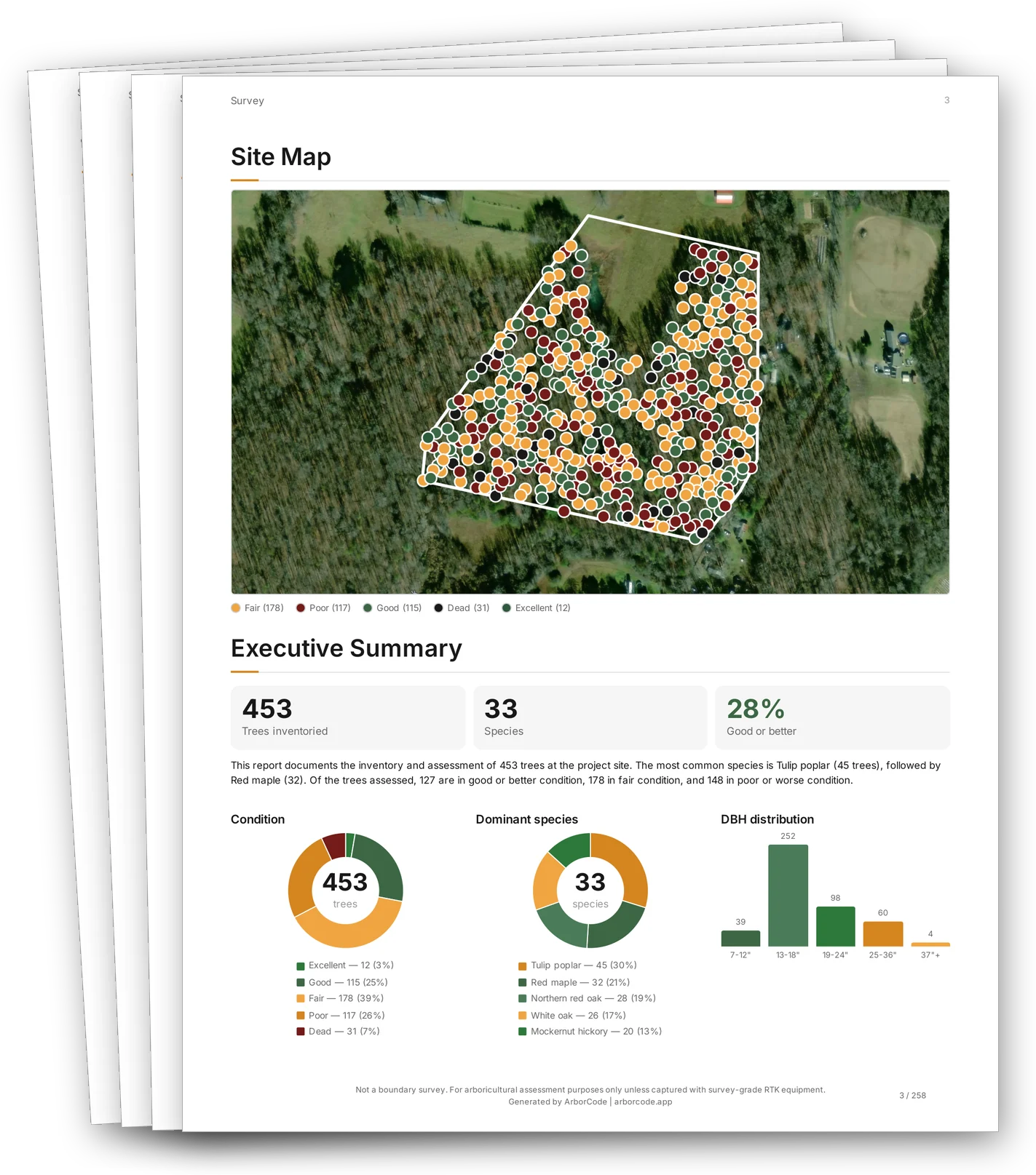
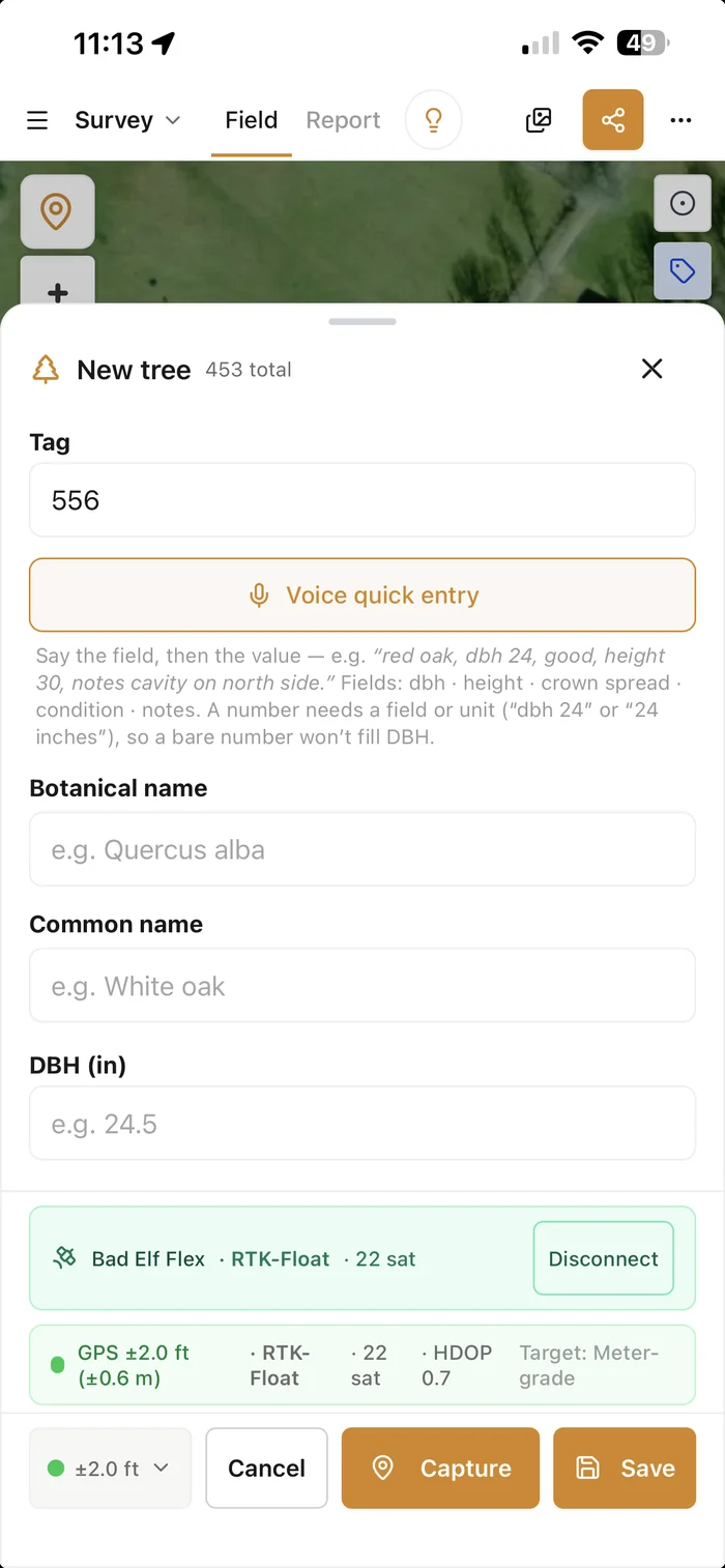
Collect the inventory on your phone, then get a CAD-ready DWG and a client-ready PDF report, without ever opening CAD.
- Survey-grade locations from a connected RTK GPS.
- A professional report and a drawing, generated in minutes.
CanopyCode™
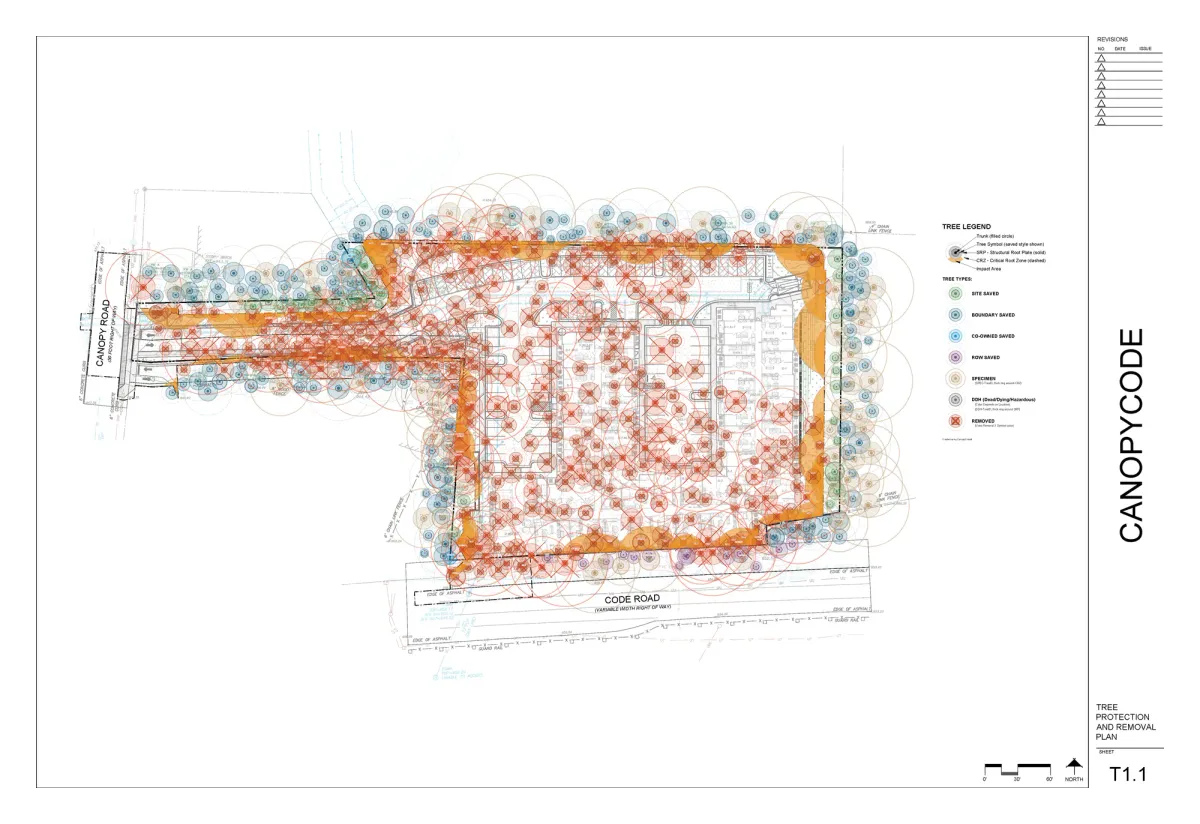
The tree-protection plan, drawn for you.
Place trees from a CSV, then get the critical-root-zone rings, impact analysis, and the legend placed automatically, right inside AutoCAD and Civil 3D.
- Save 15 to 20 hours on a typical tree-protection plan.
- Re-run the impact when the limits of disturbance move.
SheetCode™
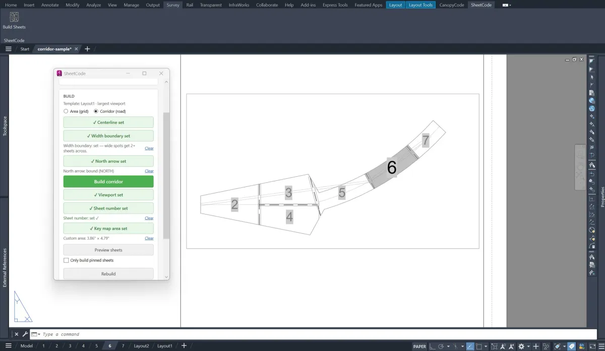
A whole sheet set, laid out in minutes.
Sheet any site boundary or road centerline: zero-gap, correctly oriented viewports with the match lines placed for you, ready to plot.
- The first pass done for you, not an afternoon of manual layout.
- Runs right inside AutoCAD and Civil 3D.
My jaw was on the floor after watching CanopyCode complete what would normally be hours of work in just minutes.
 Chris Hughes Registered Consulting Arborist, Principal Arborist
 Why we built this
Made by the people who draw the plans.
LandCode™ is built by working land-development designers who got tired of doing by hand what software should do: redrawing the same details, laying out sheet sets, and turning a day of field data into a deliverable at night. So we started building the tools we wished we had.
Across every tool we hold the same standard: accurate, traceable to your own data and the calculations behind it, and honest about its limits. When a number can't be verified, we tell you, instead of guessing. These are research tools, not legal advice.
Three tools available today, built for AutoCAD, Civil 3D, and the field, and improving every week.
Why it's different
The scattered way vs. the LandCode toolkit
One company for the drawings and the field data, instead of a dozen disconnected steps.
Questions
Frequently asked
What is LandCode?
Is any of this legal advice?
Which products can I use today?
What software do the plugins run in?
How does pricing work?
How do I get help?
Get started
Get the tedious half off your desk.
ArborCode is free to start, no credit card. Pick the job in front of you and hand off the slow part today.
Start ArborCode free, no card · 30-day money-back on CanopyCode · Your data stays yours, export anytime
A growing studio
What should we build next?
We started by taking the code busywork off people's desks, and we keep going wherever the work is slow and manual. If there's a task in your day that a good tool could handle, tell us. The best ideas come from the people doing the work.
- Field tools, plan automation, report generation, or something we haven't thought of yet.
- We read every idea, and we follow up when we build one.
Send us your idea
A sentence is plenty. Tell us the task you wish would just do itself.
Email your ideaGoes straight to the team. No form, no signup.